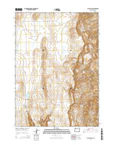
2014 Map of Big Mud Flat
USGS Topo · Published 2014About this map
Big Mud Flat and the surrounding high desert of Malheur County define this remote landscape in the early 21st century. The map reveals a land managed for water and livestock, characterized by numerous small catchment points and family-named landmarks. Features like Harry Page Reservoir, David Kent Reservoir, and Ben Odell Reservoir indicate the personal history of land use in this arid region, where every spring and basin is essential.
Find a feature on this map
25 named features on this map. Tap any name to fly to it.
Don’t see what you’re looking for? This feature index may not catch every label — zoom into the map to look around manually.
Map Details
Editions of this 2014 Big Mud Flat Map
This is the sole edition of this map. No revisions or reprints were ever made.
Other maps of this area

1955 · Boise
USGS Topo · 1:250,000

1958 · Boise
USGS Topo · 1:250,000

1962 · Boise
USGS Topo · 1:250,000

1967 · Diamond Butte
USGS Topo · 1:24,000

1967 · Quartz Mtn Basin
USGS Topo · 1:24,000

1969 · Jordan Craters North
USGS Topo · 1:24,000

1972 · Cedar Mountain
USGS Topo · 1:24,000

1972 · Big Mud Flat
USGS Topo · 1:24,000
1972 · Wall Rock Springs
USGS Topo · 1:24,000
1972 · Rinehart Canyon
USGS Topo · 1:24,000