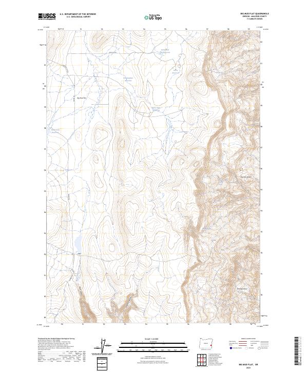
2023 Map of Big Mud Flat
USGS Topo · Published 2023About this map
Big Mud Flat and the surrounding high desert of Malheur County are defined by a complex network of water management features essential to this arid region. The landscape is dotted with several family-named and geographic impoundments, including the Little Mud Flat Reservoir, Knottingham Reservoir, Harry Page Reservoir, and David Kent Reservoir. These water sources, along with natural features like Whiskey Springs and Willow Springs, suggest a history of ranching and livestock management in a territory where water is the primary currency. To the east, the terrain breaks sharply at the Owyhee Breaks, while the south is characterized by the deep incisions of Black Canyon and Juniper Canyon. Simple dirt tracks like Mud Flat Rd and Turner Rd provide the only access through this remote portion of southeastern Oregon, connecting the high basins like Wrangle Basin to the broader flats.
Find a feature on this map
22 named features on this map. Tap any name to fly to it.
Don’t see what you’re looking for? This feature index may not catch every label — zoom into the map to look around manually.
Map Details
Editions of this 2023 Big Mud Flat Map
This is the sole edition of this map. No revisions or reprints were ever made.
Other maps of this area

1955 · Boise
USGS Topo · 1:250,000

1958 · Boise
USGS Topo · 1:250,000

1962 · Boise
USGS Topo · 1:250,000

1967 · Diamond Butte
USGS Topo · 1:24,000

1967 · Quartz Mtn Basin
USGS Topo · 1:24,000

1969 · Jordan Craters North
USGS Topo · 1:24,000

1972 · Cedar Mountain
USGS Topo · 1:24,000

1972 · Big Mud Flat
USGS Topo · 1:24,000
1972 · Wall Rock Springs
USGS Topo · 1:24,000
1972 · Rinehart Canyon
USGS Topo · 1:24,000