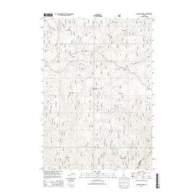
2013 Map of Big Owl Creek
USGS Topo · Published 2013About this map
Boise National Forest dominates this mountain landscape where the Boise and Elmore County line follows the high ridges. The map illustrates a complex network of forest drainage systems, with the South Fork Payette River cutting across the southern edge and the Crooked River winding through the center. Small-scale development is concentrated in areas like Hurdy Flat, which serves as a rare pocket of level terrain amidst the steep slopes. Recreational and ranching footprints are visible at Beaver Creek Youth Camp and Kempner Ranch, while several public sites like Edna Creek Campground and Willow Creek Campground indicate the area's use for backcountry access. The intricate system of tributaries, including Pikes Fork, Big Owl Cr, and China Fork, highlights the watershed's importance to the regional geography of central Idaho.
Find a feature on this map
33 named features on this map. Tap any name to fly to it.
Don’t see what you’re looking for? This feature index may not catch every label — zoom into the map to look around manually.
Map Details
Editions of this 2013 Big Owl Creek Map
This is the sole edition of this map. No revisions or reprints were ever made.
Other maps of this area

1891 · Bear Valley
USGS Topo · 1:125,000

1893 · Bear Valley
USGS Topo · 1:125,000

1894 · Idaho Basin
USGS Topo · 1:125,000

1894 · Rocky Bar
USGS Topo · 1:125,000

1909 · Garden Valley
USGS Topo · 1:125,000

1955 · Hailey
USGS Topo · 1:250,000

1957 · Challis
USGS Topo · 1:250,000

1959 · Hailey
USGS Topo · 1:250,000

1960 · Challis
USGS Topo · 1:250,000

1962 · Hailey
USGS Topo · 1:250,000