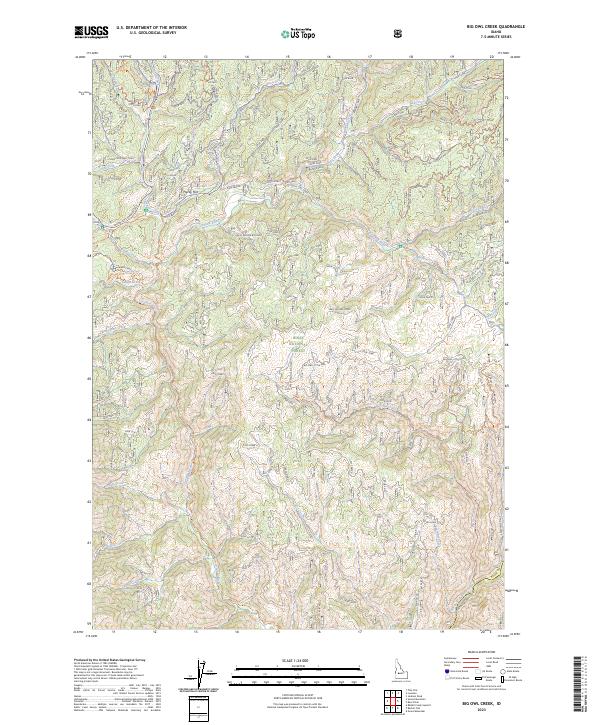
2023 Map of Big Owl Creek
USGS Topo · Published 2023About this map
Boise National Forest encompasses the entirety of this mountainous Idaho terrain, defined by a dense network of watercourses and ridgelines. The North Fork Boise River flows across the southeastern corner, while the Crooked River and Big Owl Creek dominate the central and northern drainages. These waters are separated by prominent landforms such as Lost Creek Ridge and West Willow Ridge, suggesting a landscape shaped by narrow canyons and timbered heights. Settlement is nearly non-existent, represented instead by scattered geographical points like Hurdy Flat and Valley Flat.
Find a feature on this map
50 named features on this map. Tap any name to fly to it.
Don’t see what you’re looking for? This feature index may not catch every label — zoom into the map to look around manually.
Map Details
Editions of this 2023 Big Owl Creek Map
This is the sole edition of this map. No revisions or reprints were ever made.
Other maps of this area

1891 · Bear Valley
USGS Topo · 1:125,000

1893 · Bear Valley
USGS Topo · 1:125,000

1894 · Idaho Basin
USGS Topo · 1:125,000

1894 · Rocky Bar
USGS Topo · 1:125,000

1909 · Garden Valley
USGS Topo · 1:125,000

1955 · Hailey
USGS Topo · 1:250,000

1957 · Challis
USGS Topo · 1:250,000

1959 · Hailey
USGS Topo · 1:250,000

1960 · Challis
USGS Topo · 1:250,000

1962 · Hailey
USGS Topo · 1:250,000