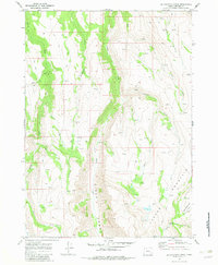
1968 Map of Big Pasture Creek
USGS Topo · Published 1983About this map
Steens Mountain dominates this portion of Harney County, characterized by the dramatic incision of Kiger Gorge and a complex drainage system. In the late 1960s, this landscape was defined by its water sources and high-elevation terrain, where Kiger Creek and Cucamonga Creek flow through deeply carved valleys. The presence of Doe Camp indicates seasonal human activity in an area otherwise managed through a network of pack trails and jeep trails. Numerous springs feed small tributaries like Snow Creek, Horton Creek, and Dingle Creek, which eventually reach the larger basins. The eastern portion of the sheet is marked by the distinct Big Pasture Creek and the curiously named Hole in the Ground Creek, reflecting the specific geography of the Oregon high desert before modern infrastructural expansion shifted local access patterns.
Find a feature on this map
18 named features on this map. Tap any name to fly to it.
Don’t see what you’re looking for? This feature index may not catch every label — zoom into the map to look around manually.
Map Details
Editions of this 1968 Big Pasture Creek Map
3 editions found
Other maps of this area

1955 · Adel
USGS Topo · 1:250,000

1957 · Adel
USGS Topo · 1:250,000

1958 · Adel
USGS Topo · 1:250,000

1962 · Adel
USGS Topo · 1:250,000

1968 · Poison Springs
USGS Topo · 1:24,000

1968 · Fish Lake
USGS Topo · 1:24,000

1968 · Wildhorse Lake
USGS Topo · 1:24,000
1968 · Krumbo Ridge
USGS Topo · 1:24,000

1968 · Big Pasture Creek
USGS Topo · 1:24,000
1968 · Mc Coy Ridge
USGS Topo · 1:24,000