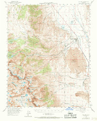
1958 Map of Big Pine
USGS Topo · Published 1969About this map
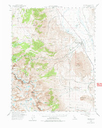
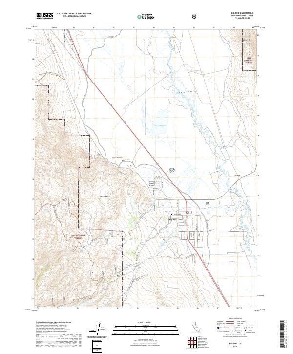
Big Pine serves as the focal point of this Eastern Sierra study, situated at the base of a dramatic transition from the Owens River valley floor to the high peaks of the Inyo National Forest. The map illustrates a landscape of stark contrasts, where the irrigated agricultural lands of the Owens Valley Ranch and the small siding at Zurich on the Southern Pacific railroad sit just miles from the massive volcanic flows of Lava and Crater Mountain. To the west, the terrain rises sharply into the Sierra Nevada, reaching its apex at glacial features like the Middle Palisade Glacier and the Palisade Crest. This 1950s record provides critical detail for researchers tracing the early tourism infrastructure of the region, including the location of Glacier Lodge and the system of high-altitude trails like the Baker Trail that provided access to the remote Big Pine Lakes.
Find a feature on this map
71 named features on this map. Tap any name to fly to it.
Don’t see what you’re looking for? This feature index may not catch every label — zoom into the map to look around manually.
Map Details
Editions of this 1958 Big Pine Map
This is the sole edition of this map. No revisions or reprints were ever made.
Historical Maps of Big Pine Through Time
8 maps found