
1943 Map of Big Pine Mountain
USGS Topo · Published 1943About this map
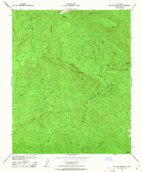
The Condor Sanctuary dominates the northern reaches of this 1943 survey, a protected landscape within the Los Padres National Forest before the era of intensive backcountry development. The map detail highlights the high-altitude topography of the San Rafael Mountains, centered on the 6,828-foot Big Pine Mtn. A network of remote administrative and recreational outposts is evident, from the West Big Pine Lookout to the Alamar Guard Sta and Bluff Camp. This era of management by the U.S. Forest Service is preserved in labels for isolated structures like Pelch Cabin and the secluded Mission Pine Basin. Water sources such as Sisquoc Falls and the headwaters of the Sisquoc River are precisely mapped, tracing the drainage patterns through Rattlesnake Canyon and Big Pine Canyon toward the Narrows.
Find a feature on this map
23 named features on this map. Tap any name to fly to it.
Don’t see what you’re looking for? This feature index may not catch every label — zoom into the map to look around manually.
Map Details
Editions of this 1943 Big Pine Mountain Map
2 editions found
Other maps of this area

1902 · Santa Ynez
USGS Topo · 1:125,000

1905 · Santa Ynez
USGS Topo · 1:125,000

1941 · San Rafael Mtn.
USGS Topo · 1:62,500

1941 · McPherson Peak
USGS Topo · 1:62,500

1942 · San Rafael Mtn.
USGS Topo · 1:62,500

1942 · Little Pine Mountain
USGS Topo · 1:24,000

1943 · San Rafael Mtn.
USGS Topo · 1:62,500

1943 · McPherson Peak
USGS Topo · 1:62,500

1943 · Hildreth Peak
USGS Topo · 1:24,000
1943 · Fox Mountain
USGS Topo · 1:24,000