
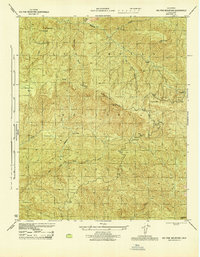
1942 Map of Little Pine Mountain
USGS Topo · Published 1964About this map
The Santa Ynez River carves through the heart of the Los Padres National Forest on this 1940s-era topographic study. This map documents a critical period in the region's hydraulic history, centered on the Santa Barbara Reservoir and the Gibraltar Dam. The presence of the Santa Barbara Water Tunnel underscores the engineering efforts required to move water through the Santa Ynez Mountains to the coast. Beyond its utility, the landscape is defined by resource extraction and land management, featuring a Quicksilver Mine to the east and the Santa Ynez Game Refuge to the south. Higher elevations are marked by fire and forestry infrastructure, including the Camuesa Pk Lookout and the Happy Hollow Guard Station, while recreation is noted at the Mono Public Camp.
Find a feature on this map
20 named features on this map. Tap any name to fly to it.
Don’t see what you’re looking for? This feature index may not catch every label — zoom into the map to look around manually.
Map Details
Editions of this 1942 Little Pine Mountain Map
This is the sole edition of this map. No revisions or reprints were ever made.
Other maps of this area

1902 · Santa Ynez
USGS Topo · 1:125,000

1905 · Santa Ynez
USGS Topo · 1:125,000

1941 · San Rafael Mtn.
USGS Topo · 1:62,500

1942 · Goleta
USGS Topo · 1:62,500

1942 · San Rafael Mtn.
USGS Topo · 1:62,500

1943 · Big Pine Mountain
USGS Topo · 1:31,680

1943 · San Rafael Mtn.
USGS Topo · 1:62,500

1943 · Hildreth Peak
USGS Topo · 1:24,000

1944 · Santa Barbara
USGS Topo · 1:31,680
1944 · Big Pine Mtn
USGS Topo · 1:31,680