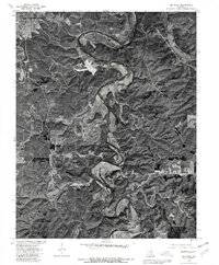
1976 Map of Big Piney
USGS Topo · Published 1980About this map
Big Piney River carves a deep, serpentine path through this 1976 orthophotoquad, revealing the complex Ozark topography that defined local development in Pulaski County. This aerial perspective, prepared in cooperation with the Soil Conservation Service, captures the landscape at a point when the northern extent was dominated by the military reservation of Fort Leonard Wood. The imagery highlights the stark contrast between the dense forest cover on the steep ridges and the cleared bottomlands along the river’s bends.
Find a feature on this map
6 named features on this map. Tap any name to fly to it.
Don’t see what you’re looking for? This feature index may not catch every label — zoom into the map to look around manually.
Map Details
Editions of this 1976 Big Piney Map
This is the sole edition of this map. No revisions or reprints were ever made.
Other maps of this area

1912 · Rolla
USGS Topo · 1:62,500

1936 · Waynesville
USGS Topo · 1:48,000

1937 · Edgar Springs
USGS Topo · 1:48,000

1941 · Big Piney
USGS Topo · 1:62,500

1942 · Waynesville
USGS Topo · 1:62,500

1943 · Big Piney
USGS Topo · 1:62,500

1944 · Waynesville
USGS Topo · 1:62,500

1945 · Edgar Springs
USGS Topo · 1:62,500

1949 · Rolla
USGS Topo · 1:250,000
1950 · Kaintuck Hollow
USGS Topo · 1:24,000