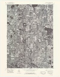
1976 Map of Big Rapids NE
USGS Topo · Published 1979About this map
Chippewa Lake sits at the northern edge of this orthophotoquad, serving as a primary focal point for this rural landscape in central Michigan. The 1976 aerial photography reveals a mosaic of rectangular agricultural fields and dense woodlots characteristic of the region's mid-century farming patterns. The small settlement of Rodney is visible in the central portion of the sheet, surrounded by a network of sectional roads that connect the isolated farmsteads. To the east, the waters of Jernzen Lake and Horsehead Lake break up the land, surrounded by wooded shoreline that suggests a mix of natural cover and burgeoning seasonal recreation. This survey, produced in cooperation with the Michigan Department of Natural Resources, provides a precise visual record of the land use before significant modern suburban expansion or further agricultural consolidation altered these township corridors.
Find a feature on this map
5 named features on this map. Tap any name to fly to it.
Don’t see what you’re looking for? This feature index may not catch every label — zoom into the map to look around manually.
Map Details
Editions of this 1976 Big Rapids NE Map
This is the sole edition of this map. No revisions or reprints were ever made.
Other maps of this area

1954 · Midland
USGS Topo · 1:250,000

1958 · Midland
USGS Topo · 1:250,000

1958 · Big Rapids
USGS Topo · 1:62,500

1959 · Midland
USGS Topo · 1:250,000

1959 · Lake
USGS Topo · 1:62,500

1959 · Evart
USGS Topo · 1:62,500

1964 · Mecosta NW
USGS Topo · 1:24,000

1964 · Mecosta
USGS Topo · 1:24,000

1966 · Midland
USGS Topo · 1:250,000

1976 · Big Rapids SE
USGS Topo · 1:24,000