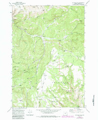
1969 Map of Big Rock Flat
USGS Topo · Published 1984About this map
Anson Wright Memorial Park and the rugged northern reaches of the Umatilla National Forest define this landscape in the Blue Mountains. The map reveals a remote geography of high flats and steep drainage canyons, where early timber and ranching operations are evidenced by sites like Reeds Mill and Parkers Mill. These small industrial footprints, alongside the Big Rock Flat Airstrip, suggest a working landscape deeply tied to the natural resources of Morrow County.
Find a feature on this map
70 named features on this map. Tap any name to fly to it.
Don’t see what you’re looking for? This feature index may not catch every label — zoom into the map to look around manually.
Map Details
Editions of this 1969 Big Rock Flat Map
2 editions found

Other maps of this area

1951 · Monument
USGS Topo · 1:62,500

1953 · Kimberly
USGS Topo · 1:62,500

1953 · Pendleton
USGS Topo · 1:250,000

1955 · Canyon City
USGS Topo · 1:250,000

1956 · Pendleton
USGS Topo · 1:250,000

1959 · Canyon City
USGS Topo · 1:250,000

1969 · Summerfield Ridge
USGS Topo · 1:24,000

1969 · Chapin Creek
USGS Topo · 1:24,000

1969 · Madison Butte
USGS Topo · 1:24,000

1969 · Hardman
USGS Topo · 1:24,000