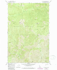
1966 Map of Big Rock Mtn
USGS Topo · Published 1987About this map
Stuart Hot Sprs stands out as a remote geothermal landmark in this high-elevation backcountry, positioned near the junction of West Fork Creek and Three Links Creek. This area of the Nez Perce National Forest is defined by its lack of roads, instead relying on an extensive network of named pathways like the Pack Trail to connect distant points.
Find a feature on this map
28 named features on this map. Tap any name to fly to it.
Don’t see what you’re looking for? This feature index may not catch every label — zoom into the map to look around manually.
Map Details
Editions of this 1966 Big Rock Mtn Map
3 editions found
Other maps of this area

1911 · Lolo
USGS Topo · 1:250,000

1913 · Lolo
USGS Topo · 1:250,000

1956 · Hamilton
USGS Topo · 1:250,000

1959 · Hamilton
USGS Topo · 1:250,000

1960 · Hamilton
USGS Topo · 1:250,000

1964 · Hamilton
USGS Topo · 1:250,000

1966 · Mc Connell Mtn
USGS Topo · 1:24,000

1966 · Moose Ridge
USGS Topo · 1:24,000
1966 · Fog Mountain
USGS Topo · 1:24,000
1966 · Big Rock Mtn
USGS Topo · 1:24,000