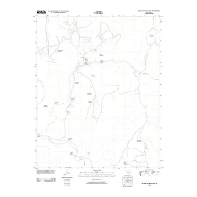
2010 Map of Big Round Mountain
USGS Topo · Published 2010About this map
Big Round Mountain and its surrounding peaks dominate the terrain in this 2010 survey of Adair County, Oklahoma. The landscape is defined by a dense network of hollows and ridges, many bearing the names of local families and colorful regional descriptors. Notable among these are John Watie Hollow, Sally Bull Hollow, and Sonny Gile Hollow, which serve as markers for genealogists tracing ancestral land use in this part of the Ozark plateau.
Find a feature on this map
38 named features on this map. Tap any name to fly to it.
Don’t see what you’re looking for? This feature index may not catch every label — zoom into the map to look around manually.
Map Details
Editions of this 2010 Big Round Mountain Map
This is the sole edition of this map. No revisions or reprints were ever made.
Other maps of this area

1898 · Winslow #3
USGS Topo · 1:62,500

1898 · Tahlequah
USGS Topo · 1:125,000

1898 · Winslow
USGS Topo · 1:125,000

1901 · Winslow
USGS Topo · 1:125,000

1901 · Tahlequah
USGS Topo · 1:125,000

1905 · Tahlequah
USGS Topo · 1:125,000

1946 · Fort Smith
USGS Topo · 1:250,000

1965 · Fort Smith
USGS Topo · 1:250,000

1967 · Fort Smith
USGS Topo · 1:250,000
1969 · Uniontown
USGS Topo · 1:24,000