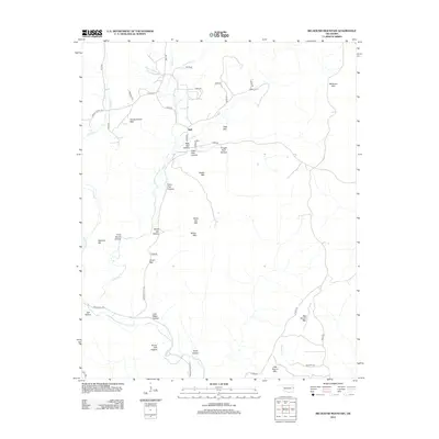
2012 Map of Big Round Mountain
USGS Topo · Published 2012About this map
Bell sits at the center of this Ozark plateau landscape, where a dense network of hollows and ridges defines the settlement patterns of Adair County. Named peaks like Workman Mtn and Vanderheiden Mtn overlook a series of family-named valleys, including John Watie Hollow and Sonny Gile Hollow, suggesting deep genealogical ties to the land. The presence of Cherokee Nation Rd and landmarks like Deer in Water Cr reflect the enduring cultural heritage of the region.
Find a feature on this map
50 named features on this map. Tap any name to fly to it.
Don’t see what you’re looking for? This feature index may not catch every label — zoom into the map to look around manually.
Map Details
Editions of this 2012 Big Round Mountain Map
This is the sole edition of this map. No revisions or reprints were ever made.
Other maps of this area

1898 · Winslow #3
USGS Topo · 1:62,500

1898 · Tahlequah
USGS Topo · 1:125,000

1898 · Winslow
USGS Topo · 1:125,000

1901 · Winslow
USGS Topo · 1:125,000

1901 · Tahlequah
USGS Topo · 1:125,000

1905 · Tahlequah
USGS Topo · 1:125,000

1946 · Fort Smith
USGS Topo · 1:250,000

1965 · Fort Smith
USGS Topo · 1:250,000

1967 · Fort Smith
USGS Topo · 1:250,000
1969 · Uniontown
USGS Topo · 1:24,000