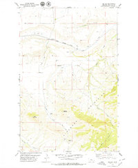
1979 Map of Big Sag
USGS Topo · Published 1979About this map
The Highwood Mountains dominate the southern portion of this Chouteau County landscape, where the terrain rises toward peaks like Gossack Mountain and Harris Mountain. In the lower elevations to the north, the Chicago Milwaukee St Paul and Pacific railroad cuts through the valley, passing by isolated Storage Bins and the drainage of Big Sag Creek. This late-1970s record captures a ranching and transport corridor defined by seasonal water sources such as Big Sag Lake and Harris Spring. Local movement is traced along the rugged Gap Road and various jeep trails, while the Upper Highwood Cem near Highwood Creek serves as a small but vital landmark for genealogists tracing family ties to this cattle and grain country. The map clearly illustrates the transition from the high ridges of the mountains to the coulee-cut plains where the railroad once moved the region’s harvest.
Find a feature on this map
20 named features on this map. Tap any name to fly to it.
Don’t see what you’re looking for? This feature index may not catch every label — zoom into the map to look around manually.
Map Details
Editions of this 1979 Big Sag Map
This is the sole edition of this map. No revisions or reprints were ever made.
Other maps of this area

1890 · Fort Benton
USGS Topo · 1:250,000

1892 · Fort Benton
USGS Topo · 1:250,000

1897 · Fort Benton
USGS Topo · 1:250,000

1954 · Great Falls
USGS Topo · 1:250,000

1954 · Rice Reservoir
USGS Topo · 1:24,000

1956 · Highwood
USGS Topo · 1:62,500

1956 · Belt
USGS Topo · 1:62,500

1957 · Great Falls
USGS Topo · 1:250,000
1972 · Shonkin NW
USGS Topo · 1:24,000
1972 · Shonkin
USGS Topo · 1:24,000