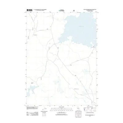
2012 Map of Big Sage Reservoir
USGS Topo · Published 2012About this map
Big Sage Reservoir dominates this high-plateau landscape in northern California, where complex water management defines the local geography. Numerous smaller catchments such as Upper Cummings Reservoir, Lower Cummings Reservoir, and Kelley Reservoir are scattered across the terrain, connected by seasonal drainage systems like W Rock Cr and Noble Cr. The presence of Devils Garden Airport and the Big Sage Campground suggests a region oriented toward backcountry utility and seasonal recreation.
Find a feature on this map
24 named features on this map. Tap any name to fly to it.
Don’t see what you’re looking for? This feature index may not catch every label — zoom into the map to look around manually.
Map Details
Editions of this 2012 Big Sage Reservoir Map
This is the sole edition of this map. No revisions or reprints were ever made.
Other maps of this area

1886 · Alturas
USGS Topo · 1:250,000

1892 · Alturas
USGS Topo · 1:250,000

1954 · Alturas
USGS Topo · 1:250,000

1958 · Alturas
USGS Topo · 1:250,000

1961 · Canby
USGS Topo · 1:62,500

1961 · Alturas
USGS Topo · 1:62,500

1962 · Alturas
USGS Topo · 1:250,000

1962 · Big Sage Reservoir
USGS Topo · 1:62,500

1962 · Jacks Butte
USGS Topo · 1:62,500

1965 · Alturas
USGS Topo · 1:250,000