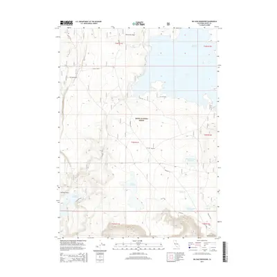
2015 Map of Big Sage Reservoir
USGS Topo · Published 2015About this map
Modoc National Forest encompasses the high desert and volcanic plateau terrain of this 2015 survey, dominated by the expansive Big Sage Reservoir. The landscape is defined by a network of water management features, including the Upper Cummings Reservoir, Lower Cummings Reservoir, and the smaller Kelley Reservoir situated in the central basin. These water bodies are vital in this arid region, where prominent geographic markers such as Whittemore Ridge and Porcupine Rim rise above the flats. The map details a remote infrastructure of forest roads like Co Road 74 and the Big Sage Reservoir road, which navigate the dramatic elevation changes of Porcupine Valley and Salisbury Gulch. Geologic and topographic points of interest, such as Mill Spring and the Barnes Grade, offer insight into the historical and ongoing management of these public lands in northeastern California.
Find a feature on this map
29 named features on this map. Tap any name to fly to it.
Don’t see what you’re looking for? This feature index may not catch every label — zoom into the map to look around manually.
Map Details
Editions of this 2015 Big Sage Reservoir Map
This is the sole edition of this map. No revisions or reprints were ever made.
Other maps of this area

1886 · Alturas
USGS Topo · 1:250,000

1892 · Alturas
USGS Topo · 1:250,000

1954 · Alturas
USGS Topo · 1:250,000

1958 · Alturas
USGS Topo · 1:250,000

1961 · Canby
USGS Topo · 1:62,500

1961 · Alturas
USGS Topo · 1:62,500

1962 · Alturas
USGS Topo · 1:250,000

1962 · Big Sage Reservoir
USGS Topo · 1:62,500

1962 · Jacks Butte
USGS Topo · 1:62,500

1965 · Alturas
USGS Topo · 1:250,000