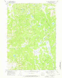
1969 Map of Big Sandy Opening
USGS Topo · Published 1973About this map
Big Sandy River and the East Fork River carve through the high country of Sublette County in this late 1960s survey. The landscape is defined by the high-altitude transition from the Bridger National Forest into the Bridger Wilderness, marked by the Wilderness Boundary Line. The presence of the Big Sandy Driveway and the Big Sandy Campground indicates a region utilized for both seasonal livestock movement and recreation. Historical travel through these glaciated basins is documented by a network of paths including the Boundary Trail and Wheeler Ranch Trail. Scattered across the granite terrain are numerous alpine water bodies such as Poston Lake, Twin Lakes, and Mirror Lake, while expansive openings like Lamreaux Meadows and Iron Creek Meadows provide breaks in the timbered slopes beneath Laturio Mountain.
Find a feature on this map
36 named features on this map. Tap any name to fly to it.
Don’t see what you’re looking for? This feature index may not catch every label — zoom into the map to look around manually.
Map Details
Editions of this 1969 Big Sandy Opening Map
4 editions found
Other maps of this area

1937 · Moccasin Lake
USGS Topo · 1:48,000

1938 · Mt Bonneville
USGS Topo · 1:62,500

1941 · Mt Bonneville
USGS Topo · 1:62,500

1942 · Mt Bonneville
USGS Topo · 1:62,500

1943 · Moccasin Lake
USGS Topo · 1:62,500

1955 · Lander
USGS Topo · 1:250,000

1958 · Lander
USGS Topo · 1:250,000

1961 · Lander
USGS Topo · 1:250,000

1969 · Pocket Creek Lake
USGS Topo · 1:24,000

1969 · Leckie SW
USGS Topo · 1:24,000