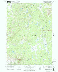
1969 Map of Big Sandy Opening
USGS Topo · Published 1986About this map
Bridger National Forest and the Bridger Wilderness dominate this high-altitude landscape in the Wind River Range, where high meadows and alpine lakes dictate the paths of early travel. The survey area centers on the Big Sandy River, tracing its course through the Lamreaux Meadows and past the Big Sandy Campground. The map reveals a complex network of pack trails and jeep tracks, such as the Pack Trail and Driveway Jeep Trail, which served as the primary conduits through the drainage systems of Dutch Joe Creek and Muddy Creek.
Find a feature on this map
41 named features on this map. Tap any name to fly to it.
Don’t see what you’re looking for? This feature index may not catch every label — zoom into the map to look around manually.
Map Details
Editions of this 1969 Big Sandy Opening Map
4 editions found
Other maps of this area

1937 · Moccasin Lake
USGS Topo · 1:48,000

1938 · Mt Bonneville
USGS Topo · 1:62,500

1941 · Mt Bonneville
USGS Topo · 1:62,500

1942 · Mt Bonneville
USGS Topo · 1:62,500

1943 · Moccasin Lake
USGS Topo · 1:62,500

1955 · Lander
USGS Topo · 1:250,000

1958 · Lander
USGS Topo · 1:250,000

1961 · Lander
USGS Topo · 1:250,000

1969 · Pocket Creek Lake
USGS Topo · 1:24,000

1969 · Leckie SW
USGS Topo · 1:24,000