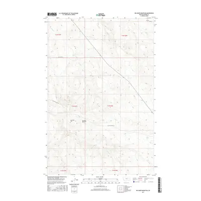
2017 Map of Big Sheep Mountain
USGS Topo · Published 2017About this map
Big Sheep Mtn dominates the high ground of the Big Sheep Mountains in this 2017 survey of Prairie County, Montana. The landscape is defined by the complex drainage patterns of seasonal and perennial waterways, including W Duck Cr, E Duck Cr, and Plenty Cr, which carve through the terrain. Evidence of rural infrastructure is found in the network of unpaved access routes like Big Sheep Mountain Rd and Duck Creek Rd, which follow the natural contours of the land. A notable water source in this arid environment is Mud Spring, located in the southeastern quadrant. The map provides a precise look at the Public Land Survey System divisions, showing the boundaries between t16n r47e and surrounding townships, a critical detail for those tracking specific land parcels or historic grazing allotments.
Find a feature on this map
16 named features on this map. Tap any name to fly to it.
Don’t see what you’re looking for? This feature index may not catch every label — zoom into the map to look around manually.
Map Details
Editions of this 2017 Big Sheep Mountain Map
This is the sole edition of this map. No revisions or reprints were ever made.
Other maps of this area

1953 · Miles City
USGS Topo · 1:250,000

1954 · Glendive
USGS Topo · 1:250,000

1957 · Miles City
USGS Topo · 1:250,000

1957 · Glendive
USGS Topo · 1:250,000

1958 · Miles City
USGS Topo · 1:250,000

1958 · Glendive
USGS Topo · 1:250,000

1965 · Little Sheep Mountain
USGS Topo · 1:24,000

1965 · Watkins SE
USGS Topo · 1:24,000

1965 · Watkins
USGS Topo · 1:24,000

1972 · Mc Cloud
USGS Topo · 1:24,000