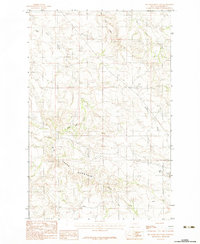
1983 Map of Big Sheep Mountain
USGS Topo · Published 1983About this map
Big Sheep Mountain dominates the southern landscape of this Prairie County quadrangle, serving as a primary topographical anchor for the region. The map captures a network of ephemeral and perennial drainages including West Duck Creek, East Duck Creek, and Plenty Creek, which carve through the high plains terrain. A notable human landmark is the Radio Tower located west of the mountain, indicating the integration of communication infrastructure into this rural ranching environment. Small-scale industrial activity is evidenced by a Gravel Pit near the northern boundary, while local water sources like Mud Spr highlight the importance of specific points for livestock and land management in this arid stretch of eastern Montana. The arrangement of improved and unimproved roads following section lines demonstrates the enduring impact of the Public Land Survey System on regional transit.
Find a feature on this map
10 named features on this map. Tap any name to fly to it.
Don’t see what you’re looking for? This feature index may not catch every label — zoom into the map to look around manually.
Map Details
Editions of this 1983 Big Sheep Mountain Map
This is the sole edition of this map. No revisions or reprints were ever made.
Other maps of this area

1953 · Miles City
USGS Topo · 1:250,000

1954 · Glendive
USGS Topo · 1:250,000

1957 · Miles City
USGS Topo · 1:250,000

1957 · Glendive
USGS Topo · 1:250,000

1958 · Miles City
USGS Topo · 1:250,000

1958 · Glendive
USGS Topo · 1:250,000

1965 · Little Sheep Mountain
USGS Topo · 1:24,000

1965 · Watkins SE
USGS Topo · 1:24,000

1965 · Watkins
USGS Topo · 1:24,000

1972 · Mc Cloud
USGS Topo · 1:24,000