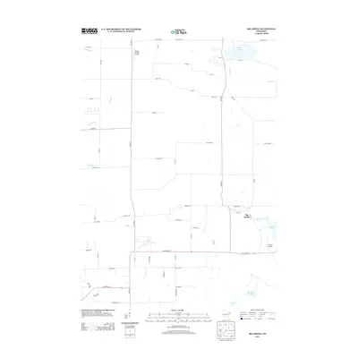
2013 Map of Big Spring
USGS Topo · Published 2013About this map
Big Spring and Davis Corners anchor this rural landscape in Adams and Columbia Counties as it appeared in 2013. The area is defined by a series of small, glacial lakes and winding waterways, including the waters of Jordan Lake and Mason Lake. The map reveals a mix of recreational and agricultural land use, punctuated by small private landing strips such as Polish Paradise Airport and Gaffney Airport.
Find a feature on this map
55 named features on this map. Tap any name to fly to it.
Don’t see what you’re looking for? This feature index may not catch every label — zoom into the map to look around manually.
Map Details
Editions of this 2013 Big Spring Map
This is the sole edition of this map. No revisions or reprints were ever made.
Other maps of this area

1901 · The Dells
USGS Topo · 1:62,500

1902 · Briggsville
USGS Topo · 1:62,500

1957 · Wisconsin Dells
USGS Topo · 1:62,500

1957 · Madison
USGS Topo · 1:250,000

1958 · Briggsville
USGS Topo · 1:62,500

1960 · Madison
USGS Topo · 1:250,000

1961 · Oxford
USGS Topo · 1:62,500

1961 · Adams
USGS Topo · 1:62,500
1975 · Wisconsin Dells SE
USGS Topo · 1:24,000
1975 · Wisconsin Dells NE
USGS Topo · 1:24,000