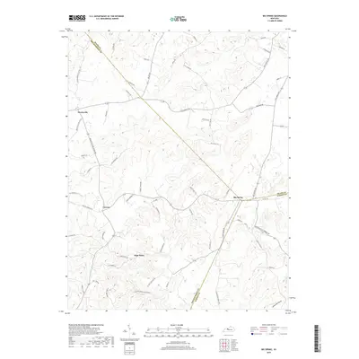
2019 Map of Big Spring
USGS Topo · Published 2019About this map
The tri-county intersection of Breckinridge, Meade, and Hardin counties anchors this landscape of the Pennyroyal plateau. The small community of Big Spring sits at the eastern edge, while Bewleyville and Corners define the western reaches. This area is characterized by a network of rural roads often named for local families and landmarks, such as St Clair Cemetery Rd and Paul Farm Rd.
Find a feature on this map
66 named features on this map. Tap any name to fly to it.
Don’t see what you’re looking for? This feature index may not catch every label — zoom into the map to look around manually.
Map Details
Editions of this 2019 Big Spring Map
This is the sole edition of this map. No revisions or reprints were ever made.
Other maps of this area

1928 · Hardinsburg
USGS Topo · 1:48,000

1931 · Hardinsburg
USGS Topo · 1:62,500

1932 · Big Clifty
USGS Topo · 1:62,500

1941 · Ekron
USGS Topo · 1:62,500

1946 · Rock Haven
USGS Topo · 1:24,000

1947 · Irvington
USGS Topo · 1:24,000

1947 · Garfield
USGS Topo · 1:24,000

1947 · Hardinsburg
USGS Topo · 1:62,500

1947 · Ekron
USGS Topo · 1:62,500
1948 · Guston
USGS Topo · 1:24,000