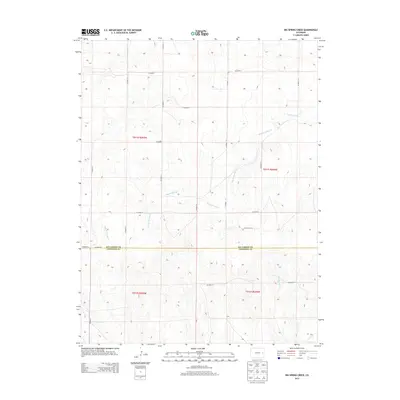
2013 Map of Big Spring Creek
USGS Topo · Published 2013About this map
The Kit Carson and Cheyenne county line divides this high plains landscape, where agricultural land use is defined by a rigid grid of section lines and gravel roads. In this early twenty-first century survey, the intermittent drainage of Big Spring Cr and its tributary, East Br Spring Cr, meander across the plateau, breaking the geometric regularity of the surveyor's townships. These watercourses are vital landmarks in an otherwise uniform terrain, with Pass Cr appearing in the southwestern corner. The mapping reflects a modern era of rural infrastructure, where routes like Co Road 15 and Co Road F provide the primary framework for local travel and ranch access. This specific study of the Big Spring Creek quadrangle preserves the exact configuration of property boundaries and local transport corridors at a moment of transition in eastern Colorado.
Find a feature on this map
23 named features on this map. Tap any name to fly to it.
Don’t see what you’re looking for? This feature index may not catch every label — zoom into the map to look around manually.
Map Details
Editions of this 2013 Big Spring Creek Map
This is the sole edition of this map. No revisions or reprints were ever made.
Other maps of this area

1891 · Arroyo
USGS Topo · 1:125,000

1891 · Kit Carson
USGS Topo · 1:125,000

1893 · Arroyo
USGS Topo · 1:125,000

1893 · Kit Carson
USGS Topo · 1:125,000

1954 · Limon
USGS Topo · 1:250,000

1954 · Lamar
USGS Topo · 1:250,000

1957 · Limon
USGS Topo · 1:250,000

1958 · Limon
USGS Topo · 1:250,000

1958 · Lamar
USGS Topo · 1:250,000

1978 · Sanders Ranch
USGS Topo · 1:24,000