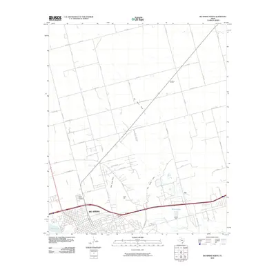
2010 Map of Big Spring North
USGS Topo · Published 2010About this map
The high plains of Howard County are anchored by the northern expansion of Big Spring, shown here just as the modern decade began. The landscape is a study in industrial and hydraulic management, dominated by the Big Spring Oil Field and the petroleum infrastructure surrounding Refinery Lake and Refinery Dam. Water management is central to the area's layout, with ephemeral features like Big Sandy Draw and Little Sandy Draw cutting across the terrain toward the southern drainage of Beals Creek. Cultural and genealogical landmarks provide historical depth to the grid-patterned growth, including the prominent Mount Olive Cemetery on the edge of the city and the elevation of Gold Hill. Small settlements and road junctions like Ziler mark the transition from the dense urban streets of the city's northern neighborhoods to the wide-reaching ranch and oil roads of the surrounding countryside.
Find a feature on this map
53 named features on this map. Tap any name to fly to it.
Don’t see what you’re looking for? This feature index may not catch every label — zoom into the map to look around manually.
Map Details
Editions of this 2010 Big Spring North Map
This is the sole edition of this map. No revisions or reprints were ever made.
Other maps of this area

1941 · Morita
USGS Topo · 1:62,500

1941 · Big Spring South
USGS Topo · 1:62,500

1942 · Big Spring South
USGS Topo · 1:62,500

1942 · Big Spring North
USGS Topo · 1:62,500

1949 · Morita
USGS Topo · 1:62,500

1954 · Big Spring
USGS Topo · 1:250,000

1954 · Big Spring North
USGS Topo · 1:24,000

1954 · Big Spring North NE
USGS Topo · 1:24,000

1958 · Big Spring
USGS Topo · 1:250,000

1965 · Big Spring North
USGS Topo · 1:24,000