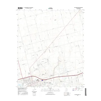
2016 Map of Big Spring North
USGS Topo · Published 2016About this map
The city of Big Spring and its surrounding High Plains landscape are documented here as they appeared in 2016, centered around the intersection of modern transportation and ancient drainage systems. The northern reaches of the city extend toward Gold Hill, while the local hydrology is defined by the ephemeral courses of Big Sandy Draw, Little Sandy Draw, and Coahoma Draw. These watercourses eventually converge with Beals Cr, which runs through the southern portion of the quadrangle alongside industrial and educational landmarks like Refinery Lake and Howard Coll. Genealogical interest centers on Mount Olive Cem located west of the city center. The map reveals the intricate grid of rural roads and highways, including the Gail Hwy and Old Colorado City Hwy, that connect the urban core of Big Spring to outlying areas like Ziler.
Find a feature on this map
132 named features on this map. Tap any name to fly to it.
Don’t see what you’re looking for? This feature index may not catch every label — zoom into the map to look around manually.
Map Details
Editions of this 2016 Big Spring North Map
This is the sole edition of this map. No revisions or reprints were ever made.
Other maps of this area

1941 · Morita
USGS Topo · 1:62,500

1941 · Big Spring South
USGS Topo · 1:62,500

1942 · Big Spring South
USGS Topo · 1:62,500

1942 · Big Spring North
USGS Topo · 1:62,500

1949 · Morita
USGS Topo · 1:62,500

1954 · Big Spring
USGS Topo · 1:250,000

1954 · Big Spring North
USGS Topo · 1:24,000

1954 · Big Spring North NE
USGS Topo · 1:24,000

1958 · Big Spring
USGS Topo · 1:250,000

1965 · Big Spring North
USGS Topo · 1:24,000