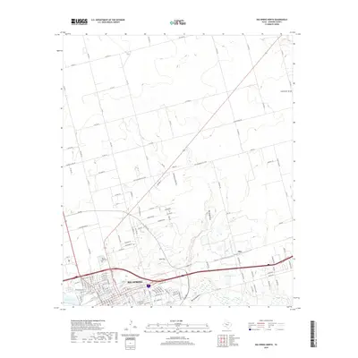
2019 Map of Big Spring North
USGS Topo · Published 2019About this map
Big Spring anchors the southern portion of this West Texas landscape, where the urban grid meets the desert draws of Howard County. The map documents the northern expansion of the city beyond the historic corridor of Beals Creek, showing a dense network of residential streets and named boulevards like Baylor Blvd and Bucknell Ave. Near the city's edge, Refinery Lake and Onemile Lake provide distinct water features in an otherwise arid environment, while Gold Hill rises as a prominent local landmark. Beyond the city limits, the landscape transitions into a grid of county roads bisected by deep drainage features such as Big Sandy Draw and Coahoma Draw. Researchers will find interest in the location of Mount Olive Cemetery and the outlying settlement of Ziler, which highlight the historical footprint of the community as it spread toward the surrounding ranchlands.
Find a feature on this map
142 named features on this map. Tap any name to fly to it.
Don’t see what you’re looking for? This feature index may not catch every label — zoom into the map to look around manually.
Map Details
Editions of this 2019 Big Spring North Map
This is the sole edition of this map. No revisions or reprints were ever made.
Other maps of this area

1941 · Morita
USGS Topo · 1:62,500

1941 · Big Spring South
USGS Topo · 1:62,500

1942 · Big Spring South
USGS Topo · 1:62,500

1942 · Big Spring North
USGS Topo · 1:62,500

1949 · Morita
USGS Topo · 1:62,500

1954 · Big Spring
USGS Topo · 1:250,000

1954 · Big Spring North
USGS Topo · 1:24,000

1954 · Big Spring North NE
USGS Topo · 1:24,000

1958 · Big Spring
USGS Topo · 1:250,000

1965 · Big Spring North
USGS Topo · 1:24,000