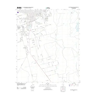
2012 Map of Big Spring South
USGS Topo · Published 2012About this map
Webb Village and the residential expansion south of the city core characterize this part of the West Texas landscape during the early 21st century. The map details the transition from the grid-based streets of the northern section, including Martin Luther King Blvd and W Marcy Dr, into the more irregular suburban developments of South Haven. Dominating the local topography are the prominent rises of Scenic Mtn and S Mtn, which overlook the historic Big Spring and Cosden Lake. This survey illustrates the vital role of water management in a semi-arid region, tracing the paths of Elbow Cr and Moss Cr alongside established landmarks like Trinity Memorial Park. The intersection of urban infrastructure and natural drainages like Plum Draw shows how the local community has integrated with the rugged geography of the Edwards Plateau's edge.
Find a feature on this map
143 named features on this map. Tap any name to fly to it.
Don’t see what you’re looking for? This feature index may not catch every label — zoom into the map to look around manually.
Map Details
Editions of this 2012 Big Spring South Map
This is the sole edition of this map. No revisions or reprints were ever made.
Other maps of this area

1941 · Morita
USGS Topo · 1:62,500

1941 · Big Spring South
USGS Topo · 1:62,500

1942 · Big Spring South
USGS Topo · 1:62,500

1942 · Big Spring North
USGS Topo · 1:62,500

1949 · Morita
USGS Topo · 1:62,500

1954 · Big Spring
USGS Topo · 1:250,000

1954 · Big Spring North
USGS Topo · 1:24,000

1958 · Big Spring
USGS Topo · 1:250,000

1965 · Big Spring North
USGS Topo · 1:24,000

1966 · Lucian Wells Ranch
USGS Topo · 1:24,000