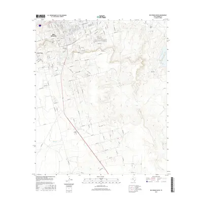
2016 Map of Big Spring South
USGS Topo · Published 2016About this map
The rugged High Plains landscape south of Big Spring unfolds in this 2016 survey, where the suburban expansion of Webb Village meets a complex network of ephemeral drainage draws and mesas. The terrain is defined by the prominent Scenic Mtn and S Mtn, which overlook the urban grid and the industrial activity near Cosden Lake. These mesas form part of the rim of the Edwards Plateau, dropping down into the wide basins of Big Spring Draw and Plum Draw.
Find a feature on this map
159 named features on this map. Tap any name to fly to it.
Don’t see what you’re looking for? This feature index may not catch every label — zoom into the map to look around manually.
Map Details
Editions of this 2016 Big Spring South Map
This is the sole edition of this map. No revisions or reprints were ever made.
Other maps of this area

1941 · Morita
USGS Topo · 1:62,500

1941 · Big Spring South
USGS Topo · 1:62,500

1942 · Big Spring South
USGS Topo · 1:62,500

1942 · Big Spring North
USGS Topo · 1:62,500

1949 · Morita
USGS Topo · 1:62,500

1954 · Big Spring
USGS Topo · 1:250,000

1954 · Big Spring North
USGS Topo · 1:24,000

1958 · Big Spring
USGS Topo · 1:250,000

1965 · Big Spring North
USGS Topo · 1:24,000
1966 · Lucian Wells Ranch
USGS Topo · 1:24,000