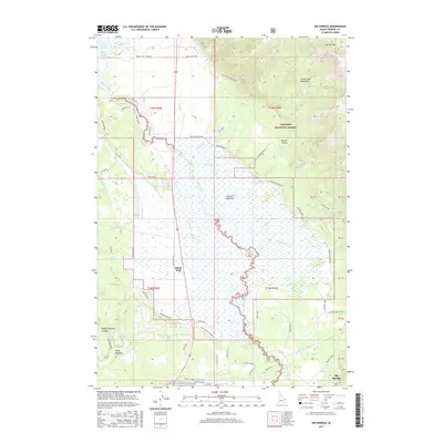
2017 Map of Big Springs
USGS Topo · Published 2017About this map
Island Park serves as a central hub in this high-altitude landscape where the headwaters of the Henrys Fork river emerge. The terrain is a complex mix of riparian basins and mountain slopes, dominated by the expansive Henrys Lake Flat and the eastern edge of Henrys Lake. Local land use is reflected in the distribution of private holdings such as Mickelson Ranch, Orme Ranch, and Kooch Ranch, which sit alongside the protected boundaries of the Targhee National Forest. The geography is defined by a dense network of watercourses, including Meadow Creek and Stephens Cr, which drain from the Henrys Lake Mountains to the north and the high canyons like Garner Canyon. Significant local landmarks include the prominent Sawtell Peak Rd and the biological diversity found at Stamp Meadows, illustrating the area's role as both a recreational gateway and a working ranching landscape in Fremont County.
Find a feature on this map
62 named features on this map. Tap any name to fly to it.
Don’t see what you’re looking for? This feature index may not catch every label — zoom into the map to look around manually.
Map Details
Editions of this 2017 Big Springs Map
This is the sole edition of this map. No revisions or reprints were ever made.
Other maps of this area

1955 · Ashton
USGS Topo · 1:250,000

1957 · Buffalo Lake
USGS Topo · 1:62,500

1958 · Ashton
USGS Topo · 1:250,000

1958 · West Yellowstone
USGS Topo · 1:62,500

1960 · Ashton
USGS Topo · 1:250,000

1964 · Island Park
USGS Topo · 1:24,000

1964 · Island Park Dam
USGS Topo · 1:24,000

1964 · Targhee Pass
USGS Topo · 1:24,000

1964 · Targhee Peak
USGS Topo · 1:24,000

1964 · Sawtell PK
USGS Topo · 1:24,000