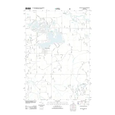
2012 Map of Big Star Lake
USGS Topo · Published 2012About this map
Big Star Lake and its surrounding glacial kettle lakes anchor this portion of the Huron-Manistee National Forests as it appeared in 2012. The lake's irregular shoreline is punctuated by local clusters like Pine Grove Beach, while the surrounding terrain is a network of smaller water bodies including Honeymoon Lake, Orchard Lake, and Basford Lake. The northern reaches are defined by the meandering Pere Marquette River, featuring the Gleasons Landing Recreation Area, a focal point for regional river access.
Find a feature on this map
80 named features on this map. Tap any name to fly to it.
Don’t see what you’re looking for? This feature index may not catch every label — zoom into the map to look around manually.
Map Details
Editions of this 2012 Big Star Lake Map
This is the sole edition of this map. No revisions or reprints were ever made.
Other maps of this area

1931 · Baldwin NW
USGS Topo · 1:31,680

1931 · Custer NE
USGS Topo · 1:31,680

1931 · Walkerville NE
USGS Topo · 1:31,680

1931 · Baldwin NE
USGS Topo · 1:31,680

1931 · Custer SE
USGS Topo · 1:31,680

1954 · Milwaukee
USGS Topo · 1:250,000

1954 · Midland
USGS Topo · 1:250,000

1958 · Midland
USGS Topo · 1:250,000

1958 · Milwaukee
USGS Topo · 1:250,000

1958 · Hesperia
USGS Topo · 1:62,500
Featured Places
- Troy Township, MI
- Pine Grove Beach, MI
- Lilley Township, MI
- Lake Township, MI
- Pleasant Plains Township, MI