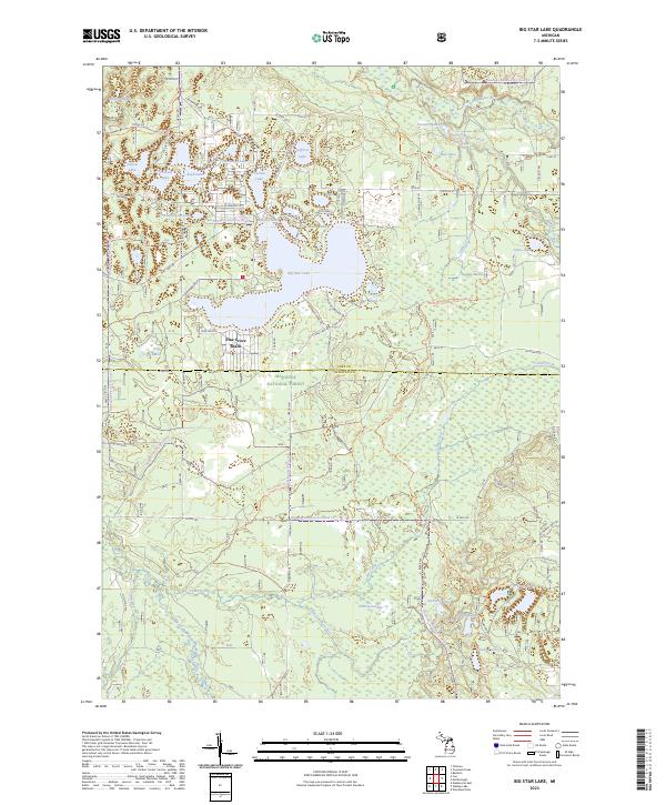
2023 Map of Big Star Lake
USGS Topo · Published 2023About this map
Big Star Lake and its surrounding glacial lake clusters anchor this study of Lake and Newaygo counties. Located within the Manistee National Forest, the landscape is defined by the transition from densely wooded timberlands to aquatic ecosystems, including the protected Pere Marquette Wild and Scenic River in the north. The seasonal community of Pine Grove Beach serves as a primary point of human settlement on the western shore of the main lake, connected by a network of forest roads and trails such as the North Country National Scenic Trl. To the south, the terrain becomes increasingly marshy, with Frog Marsh and the Triple Lakes Creek drainage system illustrating the complex hydrology of the region. This 2023 update by the U.S. Geological Survey tracks the enduring relationship between recreational development and federal conservation lands, documenting numerous named water bodies like Honeymoon Lake and Orchard Lake that have long drawn visitors to the Michigan interior.
Find a feature on this map
95 named features on this map. Tap any name to fly to it.
Don’t see what you’re looking for? This feature index may not catch every label — zoom into the map to look around manually.
Map Details
Editions of this 2023 Big Star Lake Map
This is the sole edition of this map. No revisions or reprints were ever made.
Other maps of this area

1931 · Baldwin NW
USGS Topo · 1:31,680

1931 · Custer NE
USGS Topo · 1:31,680

1931 · Walkerville NE
USGS Topo · 1:31,680

1931 · Baldwin NE
USGS Topo · 1:31,680

1931 · Custer SE
USGS Topo · 1:31,680

1954 · Milwaukee
USGS Topo · 1:250,000

1954 · Midland
USGS Topo · 1:250,000

1958 · Midland
USGS Topo · 1:250,000

1958 · Milwaukee
USGS Topo · 1:250,000

1958 · Hesperia
USGS Topo · 1:62,500
Featured Places
- Lilley Township, MI
- Troy Township, MI
- Lake Township, MI
- Pleasant Plains Township, MI
- Pine Grove Beach, MI