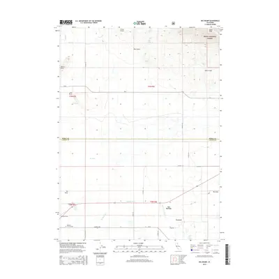
2015 Map of Big Swamp
USGS Topo · Published 2015About this map
The Pit River flows through the northwestern corner of this landscape, where the volcanic topography of the Modoc National Forest meets the hydrological complexity of Big Valley. This 2015 survey reveals an environment defined by its water sources, from the expansive Big Swamp to thermal features like Bassett Hot Springs and Kellog Hot Springs. Local infrastructure reflects the agricultural and rural character of the area, centered around the settlement of Leonard and the Southard Field airstrip.
Find a feature on this map
40 named features on this map. Tap any name to fly to it.
Don’t see what you’re looking for? This feature index may not catch every label — zoom into the map to look around manually.
Map Details
Editions of this 2015 Big Swamp Map
This is the sole edition of this map. No revisions or reprints were ever made.
Other maps of this area

1886 · Alturas
USGS Topo · 1:250,000

1886 · Modoc Lava Bed
USGS Topo · 1:250,000

1892 · Modoc Lava-Bed
USGS Topo · 1:250,000

1892 · Alturas
USGS Topo · 1:250,000

1954 · Alturas
USGS Topo · 1:250,000

1958 · Alturas
USGS Topo · 1:250,000

1961 · Canby
USGS Topo · 1:62,500

1961 · Bieber
USGS Topo · 1:62,500

1962 · Alturas
USGS Topo · 1:250,000

1962 · Crank Mountain
USGS Topo · 1:62,500