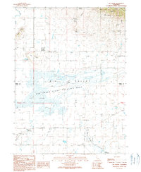
1990 Map of Big Swamp
USGS Topo · Published 1990About this map
Ash Creek State Wildlife Area dominates this portion of the Big Valley basin along the border of Lassen and Modoc counties. The terrain is characterized by the expansive wetland of the Big Swamp and the seasonal hydrology of Ash Creek. To the north, the landscape rises into the timbered slopes of the Modoc National Forest, marked by volcanic features like Roberts Butte and Pilot Butte.
Find a feature on this map
28 named features on this map. Tap any name to fly to it.
Don’t see what you’re looking for? This feature index may not catch every label — zoom into the map to look around manually.
Map Details
Editions of this 1990 Big Swamp Map
This is the sole edition of this map. No revisions or reprints were ever made.
Other maps of this area

1886 · Alturas
USGS Topo · 1:250,000

1886 · Modoc Lava Bed
USGS Topo · 1:250,000

1892 · Modoc Lava-Bed
USGS Topo · 1:250,000

1892 · Alturas
USGS Topo · 1:250,000

1954 · Alturas
USGS Topo · 1:250,000

1958 · Alturas
USGS Topo · 1:250,000

1961 · Canby
USGS Topo · 1:62,500

1961 · Bieber
USGS Topo · 1:62,500

1962 · Alturas
USGS Topo · 1:250,000

1962 · Crank Mountain
USGS Topo · 1:62,500