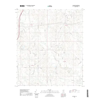
2018 Map of Big Swamp
USGS Topo · Published 2018About this map
The Wolf River meanders through the heart of Pearl River County, shaping a landscape of bottomlands and low-lying drainages in this modern topographic survey. The area is defined by its extensive wetland systems, including the namesake Big Swamp and Big Brake, alongside numerous tributaries like Alligator Cr and Beaverdam Cr. While much of the terrain is characterized by these natural water features, the map reveals a persistent rural settlement pattern through a network of family-named roads such as Oscar Lee Rd, Arthur Odom Rd, and Gumpond Beall Rd. Genealogists will find significant value in the distribution of family burial grounds, including the Beall Cem, Bond Cem, and Myrick Cem. These sites, often located near old homesteads and forest tracks, provide a clear record of the families who have long inhabited this corner of Mississippi.
Find a feature on this map
75 named features on this map. Tap any name to fly to it.
Don’t see what you’re looking for? This feature index may not catch every label — zoom into the map to look around manually.
Map Details
Editions of this 2018 Big Swamp Map
This is the sole edition of this map. No revisions or reprints were ever made.
Other maps of this area

1953 · Mobile
USGS Topo · 1:250,000

1955 · Savannah
USGS Topo · 1:62,500

1957 · Mobile
USGS Topo · 1:250,000

1958 · Carnes
USGS Topo · 1:62,500

1958 · Picayune
USGS Topo · 1:62,500

1959 · Poplarville
USGS Topo · 1:62,500

1960 · Mobile
USGS Topo · 1:250,000

1963 · Mobile
USGS Topo · 1:250,000

1965 · Mobile
USGS Topo · 1:250,000
1982 · Savannah
USGS Topo · 1:24,000