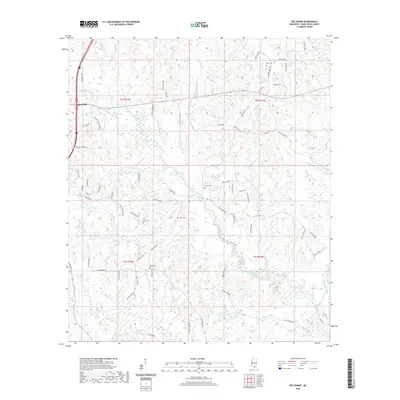
2020 Map of Big Swamp
USGS Topo · Published 2020About this map
Poplarville anchors the northwest corner of this Pearl River County landscape, where the terrain shifts from the developed corridors of Shenandoah Rd and Bennie Lumpkin Rd into the low-lying wetlands of the Wolf River basin. This contemporary survey reveals a complex hydrological network defined by slow-moving features like Waterhole Brake and Big Brake, which characterize the southern reaches of the quadrangle. The map is particularly useful for genealogical research, pinpointing numerous small burial sites such as Myrick Cem, Rester Cem, and Bond Cem tucked away from the main thoroughfares.
Find a feature on this map
79 named features on this map. Tap any name to fly to it.
Don’t see what you’re looking for? This feature index may not catch every label — zoom into the map to look around manually.
Map Details
Editions of this 2020 Big Swamp Map
This is the sole edition of this map. No revisions or reprints were ever made.
Other maps of this area

1953 · Mobile
USGS Topo · 1:250,000

1955 · Savannah
USGS Topo · 1:62,500

1957 · Mobile
USGS Topo · 1:250,000

1958 · Carnes
USGS Topo · 1:62,500

1958 · Picayune
USGS Topo · 1:62,500

1959 · Poplarville
USGS Topo · 1:62,500

1960 · Mobile
USGS Topo · 1:250,000

1963 · Mobile
USGS Topo · 1:250,000

1965 · Mobile
USGS Topo · 1:250,000
1982 · Savannah
USGS Topo · 1:24,000