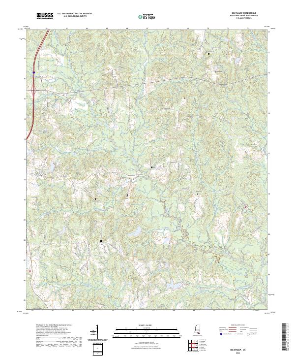
2024 Map of Big Swamp
USGS Topo · Published 2024About this map
The Wolf River defines this corner of Mississippi, carving a winding path through a landscape characterized by dense hydrology and family-held lands. The interior is marked by significant wetland features such as Big Brake and Waterhole Brake, surrounded by a complex network of small tributaries including Beaverdam Creek, Fryes Creek, and the ominously named Murder Creek. Settlement patterns are recorded through numerous family cemeteries including Myrick Cem, Frye Cem, and Rester Cem, often situated near rural junctions like Progress Rd and Restertown Rd. The topography rises toward Antler Ridge in the south, while the northern reaches show the influence of through-routes like Shenandoah Rd. This U.S. Geological Survey representation documents the modern rural structure of Pearl River County, where narrow roads like Ervin Ladner Rd and Ronnie Brown Rd provide access to the timber and swamp margins that have historically shaped local industry and community layout.
Find a feature on this map
81 named features on this map. Tap any name to fly to it.
Don’t see what you’re looking for? This feature index may not catch every label — zoom into the map to look around manually.
Map Details
Editions of this 2024 Big Swamp Map
This is the sole edition of this map. No revisions or reprints were ever made.
Other maps of this area

1953 · Mobile
USGS Topo · 1:250,000

1955 · Savannah
USGS Topo · 1:62,500

1957 · Mobile
USGS Topo · 1:250,000

1958 · Carnes
USGS Topo · 1:62,500

1958 · Picayune
USGS Topo · 1:62,500

1959 · Poplarville
USGS Topo · 1:62,500

1960 · Mobile
USGS Topo · 1:250,000

1963 · Mobile
USGS Topo · 1:250,000

1965 · Mobile
USGS Topo · 1:250,000
1982 · Savannah
USGS Topo · 1:24,000