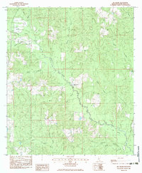
1983 Map of Big Swamp
USGS Topo · Published 1983About this map
Wolf River winds through a heavily wooded and swampy landscape in Pearl River County, where the sprawling basin of Big Swamp defines the lower terrain. This 1980s landscape is dotted with rural family landmarks and small-scale infrastructure, including a Gravel Pit and a Pipe Line cutting through the timber. The social fabric of the area is tied to several scattered burial grounds such as Beall Cem, Bond Cem, and Lee Cem, alongside the Hickory Springs Ch. Numerous smaller drainages like Alligator Creek, Beaverdam Creek, and Cowpen Creek feed into the primary river system, illustrating the intricate hydrology of the Piney Woods region. This provisional survey captures the transition from traditional rural land use toward modern additions like the Trailer Park near Wolf Creek.
Find a feature on this map
28 named features on this map. Tap any name to fly to it.
Don’t see what you’re looking for? This feature index may not catch every label — zoom into the map to look around manually.
Map Details
Editions of this 1983 Big Swamp Map
This is the sole edition of this map. No revisions or reprints were ever made.
Other maps of this area

1953 · Mobile
USGS Topo · 1:250,000

1955 · Savannah
USGS Topo · 1:62,500

1957 · Mobile
USGS Topo · 1:250,000

1958 · Carnes
USGS Topo · 1:62,500

1958 · Picayune
USGS Topo · 1:62,500

1959 · Poplarville
USGS Topo · 1:62,500

1960 · Mobile
USGS Topo · 1:250,000

1963 · Mobile
USGS Topo · 1:250,000

1965 · Mobile
USGS Topo · 1:250,000
1982 · Savannah
USGS Topo · 1:24,000