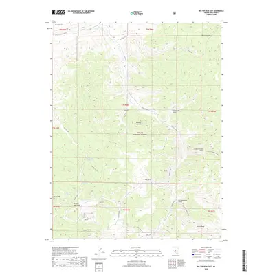
2018 Map of Big Ten Peak East
USGS Topo · Published 2018About this map
The Toiyabe National Forest encompasses the vast majority of this high-desert terrain in Nye County, dominated by the peaks and drainages of the McKinney Mountains and the Monitor Range. This landscape is defined by its isolation and the critical importance of water sources, marked by scattered perennial points like Big White Sage Spring, Mildreds Springs, and Big Ten Spring. The topographic detail reveals a network of canyons, including Big Cottonwood Canyon and Chimney Canyon, that descend from summits like Big Ten Peak. The distribution of Good Springs and the sheltered Mustang Meadow suggests a history of livestock grazing and seasonal use within this expansive public land. This area remains largely defined by the forest service infrastructure, notably Natl Forest Develop Road 007 Rd and Head Springs Road.
Find a feature on this map
36 named features on this map. Tap any name to fly to it.
Don’t see what you’re looking for? This feature index may not catch every label — zoom into the map to look around manually.
Map Details
Editions of this 2018 Big Ten Peak East Map
This is the sole edition of this map. No revisions or reprints were ever made.
Other maps of this area

1956 · Tonopah
USGS Topo · 1:250,000

1959 · Tonopah
USGS Topo · 1:250,000

1962 · Tonopah
USGS Topo · 1:250,000

1971 · Belmont East
USGS Topo · 1:24,000

1971 · Antelope Spring
USGS Topo · 1:24,000
1971 · Elkhorn Canyon
USGS Topo · 1:24,000
1971 · Georges Canyon Rim
USGS Topo · 1:24,000

1971 · Belmont West
USGS Topo · 1:24,000

1971 · Saulsbury Basin
USGS Topo · 1:24,000
1971 · McCann Canyon
USGS Topo · 1:24,000