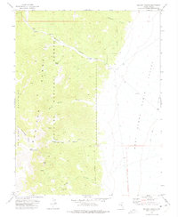
1971 Map of McCann Canyon
USGS Topo · Published 1975About this map
Longstreet Ranch and the nearby Longstreet Mine sit at the base of the Monitor Range, illustrating the historical intersection of high-desert ranching and mineral exploration in the Toiyabe National Forest. The landscape is defined by the sharp transition from the steep, spring-fed drainages of the mountains to the expansive flats of Stone Cabin Valley. Water sources such as Bernice Spring and Little Cottonwood Spring provided essential hubs for activity in an otherwise arid environment. Evidence of earlier habitation and transit is preserved at McCann Station (Site) within McCann Canyon. The map reveals a network of primitive routes, including several unnamed trails and a Jeep Trail, that connect these isolated sites across rugged terrain marked by features like Pinon Peak and the timbered slopes of Brush Bunch.
Find a feature on this map
31 named features on this map. Tap any name to fly to it.
Don’t see what you’re looking for? This feature index may not catch every label — zoom into the map to look around manually.
Map Details
Editions of this 1971 McCann Canyon Map
This is the sole edition of this map. No revisions or reprints were ever made.
Other maps of this area

1956 · Tonopah
USGS Topo · 1:250,000

1959 · Tonopah
USGS Topo · 1:250,000

1962 · Tonopah
USGS Topo · 1:250,000

1971 · Belmont East
USGS Topo · 1:24,000
1971 · Georges Canyon Rim SE
USGS Topo · 1:24,000
1971 · McIntyre Summit
USGS Topo · 1:24,000
1971 · Elkhorn Canyon
USGS Topo · 1:24,000
1971 · Georges Canyon Rim
USGS Topo · 1:24,000

1971 · Saulsbury Basin
USGS Topo · 1:24,000
1971 · Big Ten Peak East
USGS Topo · 1:24,000