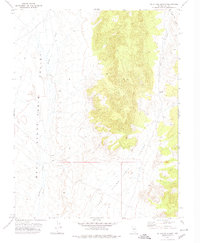
1971 Map of McIntyre Summit
USGS Topo · Published 1974About this map
Stone Cabin Valley dominates this high-desert landscape in central Nevada, situated at the boundary of Township 7 North and Township 6 North. The area is defined by the high pass at McIntyre Summit, where the terrain transitions between the expansive valley floor and the more intricate drainages of White Rocks Canyon. Water sources are critical but sparse markers in this environment, represented by the winding courses of Willow Creek to the west and Hot Creek to the northeast. This 1971 field-checked survey reveals a landscape primarily accessed by a network of unimproved routes, including a prominent Jeep Trail that cuts across the valley floor. The map records a series of benchmarks and elevation points, reflecting the meticulous work of the Geological Survey in documenting this portion of Nye County before the widespread expansion of modern infrastructure.
Find a feature on this map
8 named features on this map. Tap any name to fly to it.
Don’t see what you’re looking for? This feature index may not catch every label — zoom into the map to look around manually.
Map Details
Editions of this 1971 McIntyre Summit Map
This is the sole edition of this map. No revisions or reprints were ever made.
Other maps of this area

1956 · Tonopah
USGS Topo · 1:250,000

1959 · Tonopah
USGS Topo · 1:250,000

1962 · Tonopah
USGS Topo · 1:250,000

1968 · Tybo
USGS Topo · 1:62,500

1968 · Morey Peak
USGS Topo · 1:62,500
1968 · Flagstaff Mtn.
USGS Topo · 1:24,000
1968 · Tybo
USGS Topo · 1:24,000
1968 · Little Fish Lake
USGS Topo · 1:24,000
1971 · Georges Canyon Rim SE
USGS Topo · 1:24,000
1971 · Elkhorn Canyon
USGS Topo · 1:24,000