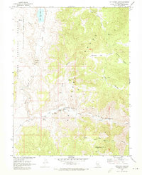
1968 Map of Little Fish Lake
USGS Topo · Published 1973About this map
Little Fish Lake Valley serves as the focal point for this 1968 topographic survey, where high-desert ranching and early industrial history intersect. The landscape is defined by the sharp rise of the Hot Creek Range, carved by deep corridors like Box Canyon and Hot Creek Canyon. Human activity in this remote Nye County basin is recorded through the Old Page Place and Old Dugan Ranch, alongside more enigmatic markers of the past like the Arrastra Ruins and the Mountain View (Site).
Find a feature on this map
39 named features on this map. Tap any name to fly to it.
Don’t see what you’re looking for? This feature index may not catch every label — zoom into the map to look around manually.
Map Details
Editions of this 1968 Little Fish Lake Map
This is the sole edition of this map. No revisions or reprints were ever made.
Other maps of this area

1956 · Tonopah
USGS Topo · 1:250,000

1959 · Tonopah
USGS Topo · 1:250,000

1962 · Tonopah
USGS Topo · 1:250,000

1967 · Blue Jay Spring
USGS Topo · 1:24,000

1967 · Upper Fish Lake
USGS Topo · 1:24,000

1967 · Morey Peak
USGS Topo · 1:24,000

1968 · Tybo
USGS Topo · 1:62,500

1968 · Morey Peak
USGS Topo · 1:62,500
1968 · Flagstaff Mtn.
USGS Topo · 1:24,000
1968 · Hobble Canyon
USGS Topo · 1:24,000