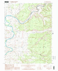
1985 Map of Big Triangle
USGS Topo · Published 1986About this map
The Colorado River carves a deep path through the high desert of Grand County in this mid-1980s survey. This specific stretch is defined by technical whitewater and precarious navigation, featuring the notable Skull Rapids, Sock-It-To-Me Rapids, and Last Chance Rapids within Westwater Canyon. These features indicate the challenging nature of the river corridor before it opens toward Cisco Landing in the northwest. Away from the river, the landscape transitions into high mesas and complex drainage systems like Dry Gulch and Coates Creek. The map documents a rugged interior accessible largely by 4WD trails, where landmarks like Big Triangle and the expansive Sand Flat dominate the topography. Evidence of human activity is sparse but specific, noted by a Gravel Pit and a remote Prospect near the canyon rims, illustrating the minimal but present industrial footprint in this canyonlands environment.
Find a feature on this map
27 named features on this map. Tap any name to fly to it.
Don’t see what you’re looking for? This feature index may not catch every label — zoom into the map to look around manually.
Map Details
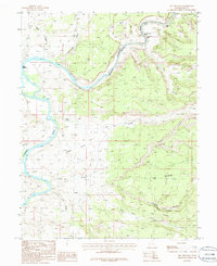
Editions of this 1985 Big Triangle Map
2 editions found
Other maps of this area

1885 · East Tavaputs
USGS Topo · 1:250,000

1885 · La Sal
USGS Topo · 1:250,000

1954 · Westwater 4 SW
USGS Topo · 1:24,000

1954 · Mt. Waas 1 SW
USGS Topo · 1:24,000

1954 · Mt. Waas 1 NE
USGS Topo · 1:24,000

1954 · Mt. Waas 1 NW
USGS Topo · 1:24,000

1954 · Mt. Waas 1 SE
USGS Topo · 1:24,000

1954 · Coates Creek
USGS Topo · 1:62,500

1955 · Mt. Waas 2 SE
USGS Topo · 1:24,000

1956 · Westwater 4 SE
USGS Topo · 1:24,000