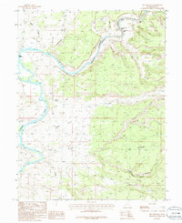
1985 Map of Big Triangle
USGS Topo · Published 1986About this map
The Colorado River snakes through the canyonlands of Grand County, Utah, defining a landscape of deep washes and high plateaus. At Cisco Landing, the waterway provides a rare access point before plunging into a series of whitewater challenges including Skull Rapids, Sock-It-To-Me Rapids, and Last Chance Rapids. These named features, alongside Funnel Falls, illustrate the river's character as it transitions through the Westwater Canyon area.
Find a feature on this map
26 named features on this map. Tap any name to fly to it.
Don’t see what you’re looking for? This feature index may not catch every label — zoom into the map to look around manually.
Map Details
Editions of this 1985 Big Triangle Map
2 editions found
Other maps of this area

1885 · East Tavaputs
USGS Topo · 1:250,000

1885 · La Sal
USGS Topo · 1:250,000

1954 · Westwater 4 SW
USGS Topo · 1:24,000

1954 · Mt. Waas 1 SW
USGS Topo · 1:24,000

1954 · Mt. Waas 1 NE
USGS Topo · 1:24,000

1954 · Mt. Waas 1 NW
USGS Topo · 1:24,000

1954 · Mt. Waas 1 SE
USGS Topo · 1:24,000

1954 · Coates Creek
USGS Topo · 1:62,500

1955 · Mt. Waas 2 SE
USGS Topo · 1:24,000

1956 · Westwater 4 SE
USGS Topo · 1:24,000