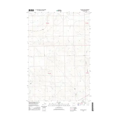
2017 Map of Big Wall East
USGS Topo · Published 2017About this map
Kilby Butte and the elevation of Big Wall dominate this landscape in Musselshell County, where the plains give way to significant topographical breaks. This 2017 survey shows a region defined by its watercourses, notably the Musselshell River cutting through the southern portion and N Willow Cr drainage to the north. The infrastructure reflects a rural ranching economy, with long-established routes such as N Gage Rd and N Delphia Rd providing primary access. Local history and ranching heritage are evident in the naming of secondary tracks and trails, including Shepherder Trl and Painted Horse Trl, while Drum Gulch and Patterson Rd suggest early family landmarks and local geographic identifiers in this part of Montana.
Find a feature on this map
17 named features on this map. Tap any name to fly to it.
Don’t see what you’re looking for? This feature index may not catch every label — zoom into the map to look around manually.
Map Details
Editions of this 2017 Big Wall East Map
This is the sole edition of this map. No revisions or reprints were ever made.
Other maps of this area

1954 · Roundup
USGS Topo · 1:250,000

1958 · Roundup
USGS Topo · 1:250,000

1963 · Musselshell NW
USGS Topo · 1:24,000

1963 · Delphia
USGS Topo · 1:24,000

1979 · Roundup
USGS Topo · 1:100,000

1979 · Gage NE
USGS Topo · 1:24,000

1979 · Chimney Butte
USGS Topo · 1:24,000

1979 · Gage
USGS Topo · 1:24,000

1986 · Big Wall West
USGS Topo · 1:24,000

1986 · Big Wall NW
USGS Topo · 1:24,000