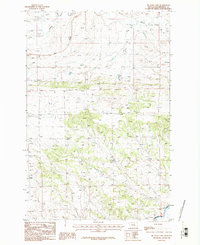
1986 Map of Big Wall East
USGS Topo · Published 1986About this map
Big Wall dominates this section of the Musselshell County landscape, rising over a network of intermittent drainage systems and ephemeral creeks. The topography is defined by significant elevation changes, ranging from the southern flow of the Musselshell River up to the prominent heights of Kilby Butte. This 1986 provisional edition captures the rural character of the region as it existed in the late 1970s, showing a land carved by Crooked Creek and Willow Creek. The map details the transition between township lines T 10 N and T 9 N, illustrating how the dry coulees and named waterways like North Willow Creek and Sand Creek dictated the placement of local roads and land use in this sparsely populated stretch of central Montana.
Find a feature on this map
10 named features on this map. Tap any name to fly to it.
Don’t see what you’re looking for? This feature index may not catch every label — zoom into the map to look around manually.
Map Details
Editions of this 1986 Big Wall East Map
This is the sole edition of this map. No revisions or reprints were ever made.
Other maps of this area

1954 · Roundup
USGS Topo · 1:250,000

1958 · Roundup
USGS Topo · 1:250,000

1963 · Musselshell NW
USGS Topo · 1:24,000

1963 · Delphia
USGS Topo · 1:24,000

1979 · Roundup
USGS Topo · 1:100,000

1979 · Gage NE
USGS Topo · 1:24,000

1979 · Chimney Butte
USGS Topo · 1:24,000

1979 · Gage
USGS Topo · 1:24,000

1986 · Big Wall West
USGS Topo · 1:24,000

1986 · Big Wall NW
USGS Topo · 1:24,000