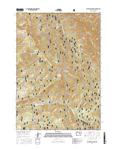
2017 Map of Big Weasel Springs
USGS Topo · Published 2017About this map
The Aldrich Mountains dominate the central topography of this 2017 survey within the Malheur National Forest. This high-altitude landscape is defined by its complex drainage network and numerous water sources, including the eponymous Big Weasel Springs and several creatively named springs such as Frankie and Johnny Spring and China Hat Spring. Higher elevations are marked by Fields Peak and Chrome Ridge, while the southern reaches of the map are bisected by Murderers Cr and its S Fork Murderers Cr. The presence of Oregon Mine Cr suggests a history of resource extraction, while the Tex Creek Arch represents a notable geological feature. Access throughout this remote area is provided by a network of Forest Service roads, including the Fields Creek Rd and several other designated forest development routes.
Find a feature on this map
52 named features on this map. Tap any name to fly to it.
Don’t see what you’re looking for? This feature index may not catch every label — zoom into the map to look around manually.
Map Details
Editions of this 2017 Big Weasel Springs Map
This is the sole edition of this map. No revisions or reprints were ever made.
Other maps of this area

1940 · Mount Vernon
USGS Topo · 1:62,500

1940 · Aldrich Mtn.
USGS Topo · 1:62,500

1943 · Aldrich Mtn.
USGS Topo · 1:62,500

1943 · Mount Vernon
USGS Topo · 1:62,500

1955 · Canyon City
USGS Topo · 1:250,000

1959 · Canyon City
USGS Topo · 1:250,000

1961 · Logdell
USGS Topo · 1:62,500

1961 · Izee
USGS Topo · 1:62,500

1972 · Big Weasel Sprs
USGS Topo · 1:24,000
1972 · Mc Clellan Mtn
USGS Topo · 1:24,000