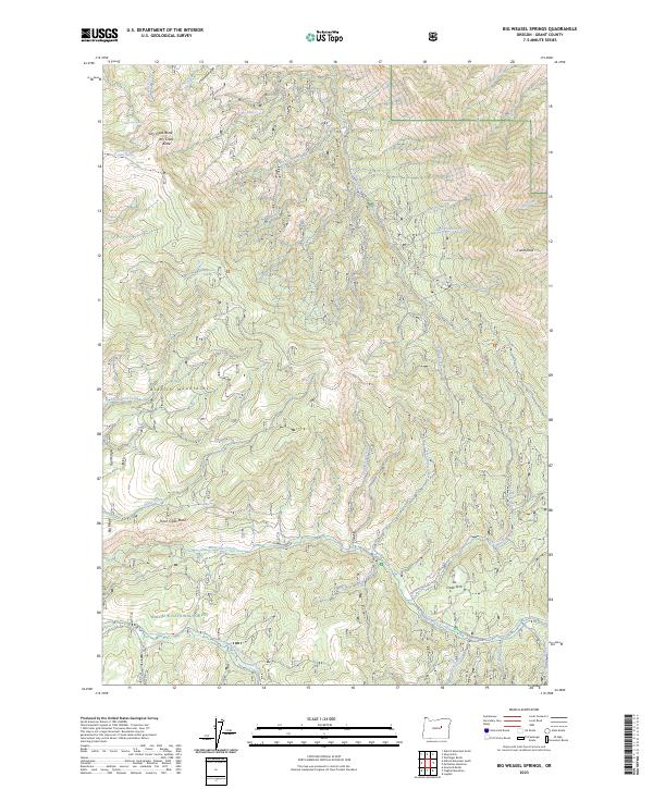
2023 Map of Big Weasel Springs
USGS Topo · Published 2023About this map
Malheur National Forest encompasses the high country of the Aldrich Mountains in this recent survey of Grant County. The terrain is characterized by a dense network of water sources and named peaks, including Fields Peak and Dry Creek Butte. Numerous springs, such as Big Weasel Springs, China Hat Spring, and the uniquely named Frankie and Johnny Spring, dot the landscape, suggesting a long history of water management for fire lookout or grazing purposes.
Find a feature on this map
40 named features on this map. Tap any name to fly to it.
Don’t see what you’re looking for? This feature index may not catch every label — zoom into the map to look around manually.
Map Details
Editions of this 2023 Big Weasel Springs Map
This is the sole edition of this map. No revisions or reprints were ever made.
Other maps of this area

1940 · Mount Vernon
USGS Topo · 1:62,500

1940 · Aldrich Mtn.
USGS Topo · 1:62,500

1943 · Aldrich Mtn.
USGS Topo · 1:62,500

1943 · Mount Vernon
USGS Topo · 1:62,500

1955 · Canyon City
USGS Topo · 1:250,000

1959 · Canyon City
USGS Topo · 1:250,000

1961 · Logdell
USGS Topo · 1:62,500

1961 · Izee
USGS Topo · 1:62,500

1972 · Big Weasel Sprs
USGS Topo · 1:24,000
1972 · Mc Clellan Mtn
USGS Topo · 1:24,000