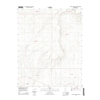
2014 Map of Big Willow Spring Canyon
USGS Topo · Published 2014About this map
Big Willow Spring Canyon defines this high-desert landscape in Apache County, where the topography is shaped by complex drainage systems and isolated water sources. The map reveals a reliance on scattered perennial points such as Big Willow Spring, Toh Del Toshi Spring, and the curiously named Looking for Water Spring. These features, along with Toh Del Toshi Hydrant, underscore the vital role of water management in this arid region of the Fort Defiance Agency. Connectivity across the high plateaus is maintained by a network of local routes including Az-264, Bia-9056, and several county roads. The northern reach is bounded by Steamboat Wash, while the southern area shows the intersection of modern transit and traditional land use near the canyon floor.
Find a feature on this map
20 named features on this map. Tap any name to fly to it.
Don’t see what you’re looking for? This feature index may not catch every label — zoom into the map to look around manually.
Map Details
Editions of this 2014 Big Willow Spring Canyon Map
This is the sole edition of this map. No revisions or reprints were ever made.
Other maps of this area

1883 · Tusayan
USGS Topo · 1:250,000

1886 · Tusayan
USGS Topo · 1:250,000

1886 · Fort Defiance
USGS Topo · 1:250,000

1892 · Fort Defiance
USGS Topo · 1:250,000

1947 · Flagstaff
USGS Topo · 1:250,000

1954 · Flagstaff
USGS Topo · 1:250,000

1954 · Gallup
USGS Topo · 1:250,000

1958 · Gallup
USGS Topo · 1:250,000

1958 · Flagstaff
USGS Topo · 1:250,000

1959 · Gallup
USGS Topo · 1:250,000
Featured Places
- Fort Defiance Agency
- Béésh Biiʼtó, Fort Defiance Agency
- Navajo County, AZ
- Apache County, AZ
- United States