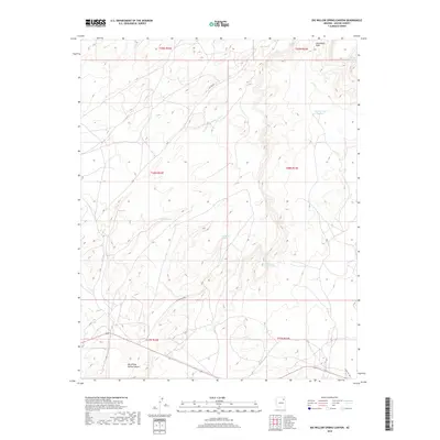
2018 Map of Big Willow Spring Canyon
USGS Topo · Published 2018About this map
Big Willow Spring Canyon dominates this portion of Apache County, where the landscape is defined by its seasonal water sources and traditional transit routes. The presence of Toh Del Toshi Hydrant and multiple named springs, including Sunrise Spring and the curiously named Looking for Water Spring, indicates the critical importance of water management in this arid region of the Fort Defiance Agency. The 2018 survey reveals a sparse network of roads, with Co Rd 427 and Indian Rte 9056 providing the primary access through the high-elevation terrain. Local drainage is directed through Steamboat Wash, which cuts across the northern section of the map, illustrating the natural flow of the land toward lower basins.
Find a feature on this map
18 named features on this map. Tap any name to fly to it.
Don’t see what you’re looking for? This feature index may not catch every label — zoom into the map to look around manually.
Map Details
Editions of this 2018 Big Willow Spring Canyon Map
This is the sole edition of this map. No revisions or reprints were ever made.
Other maps of this area

1883 · Tusayan
USGS Topo · 1:250,000

1886 · Tusayan
USGS Topo · 1:250,000

1886 · Fort Defiance
USGS Topo · 1:250,000

1892 · Fort Defiance
USGS Topo · 1:250,000

1947 · Flagstaff
USGS Topo · 1:250,000

1954 · Flagstaff
USGS Topo · 1:250,000

1954 · Gallup
USGS Topo · 1:250,000

1958 · Gallup
USGS Topo · 1:250,000

1958 · Flagstaff
USGS Topo · 1:250,000

1959 · Gallup
USGS Topo · 1:250,000
Featured Places
- Fort Defiance Agency
- Béésh Biiʼtó, Fort Defiance Agency
- Navajo County, AZ
- Apache County, AZ
- United States